
This is a crosspost of the blog on OSM.be by Joost Schouppe
Where do you go if you need a map of all the houses in Swaziland?
In the past, big money would be spent on setting up software and collecting map data. Data which would never get updated. Those days are over. NGOs with bold ideas have found a community with equally bold ideas. This community is called OpenStreetMap. Started in London in 2004 by a man with the idea to just start mapping the entire world - as a free and open dataset. Watch how the city of Ghent was mapped over the years, for instance.
But the turning point was January 12th, 2010. Within the hours after the disastrous earthquake in Haiti the area was mapped to a great detail, helping to help those in need. This proved that no-one can map quite as good, as fast and as free as OpenStreetMap. To coordinate the efforts by hundreds of thousands of volunteers, the Humanitarian OpenStreetMap Team
was formed.
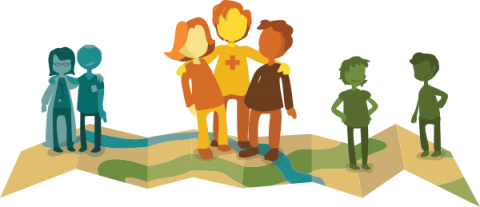
But even without disasters, elaborated and correct maps are in strong need. And this is where the Missing Maps comes in . This project aims to map all vulnerable areas in the world in as much detail as required. This project is going around the world, and Belgium is a part of it thanks to the Belgian inter-university National Comittee for Geography. While Belgium still being a divided country, mappers from seven Belgian universities in all the regions of the country will get together on the 16th April to help create the directory needed to eradicate malaria in Swaziland.
This is not a task for professional mappers. On the contrary: for most participants, it will be the first time. But this should not scare you away. OpenStreetMap Belgium is mobilizing its most experiences mappers for this event. In little more than half an hour, they will get you ready to start mapping. OpenStreetMap works very much like Wikipedia: regular people contribute what they can and when they can. We will be mapping buildings and roads, based on satellite pictures.
The second you hit save, your buildings will start appearing on hundreds of maps used around the world. And also in the datasets used by NGOs like Doctors without Borders to plan their operations. Later on, local teams will add more information to the directory.
This is a crosspost of the blogpost on OSM.be by Joost Schouppe.
We might not change the world on this day. But we will probably help to change the lives of many. Learn how maps can save lives . Be part of that, and register to come map with us at your local university.
Contact us:
Coordinating the OpenStreetMap Belgium support: Joost Schouppe
Volunteer and humanitarian mapping expert: Jorieke Vyncke
General questions @ University Team: Sophie Wambeke
Local contacts per university:
ULB: Eléonore Wolff
VUB: Frank Canters
UCL: Sophie Vanwambeke
KUL: Anton Van Rompaey
UGent: Kristien Ooms
UNamur: Catherine Linard
ULG: Cécile Deprez
More info:
Registration website
MapYear post
The event is oriented to students of the universities first, but everyone is welcome.
Can't come? Want to start on your own already? Make an OSM account, check out Learnosm.org and pick a task yourself.
Written by

Share